 Mar Menor Management & Property Sales
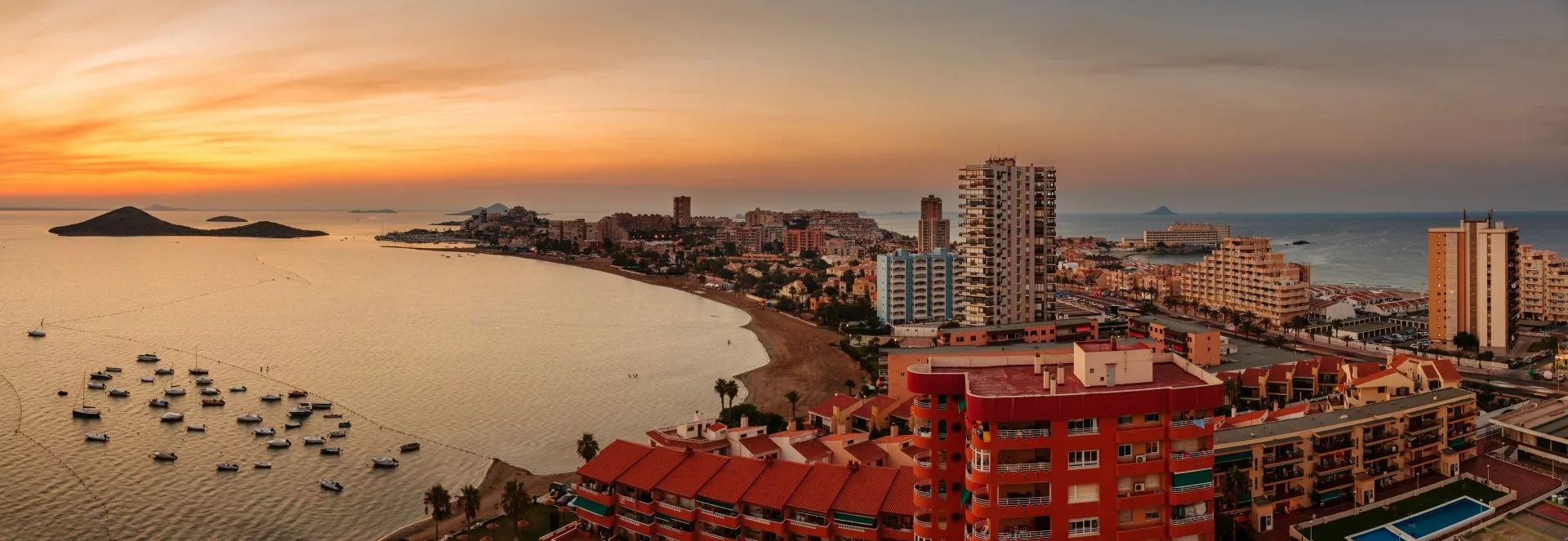
La Manga del Mar Menor
La Manga is a summer resort located in the region of Murcia, Spain, situated on a coastal strip that locals describe as a “tongue of land.” This strip connects Cabo de Palos with the Salinas de San Pedro del Pinatar, stretching over 20 kilometers and separating the Mar Menor from the Mediterranean Sea.
This extensive coastal strip is one of the most renowned areas in Murcia due to the quality and size of its beaches and coves. It attracts numerous tourists with its wonderful beaches, excellent climate, and vibrant day and night atmosphere.
The uniqueness of La Manga is evident in its geography, dividing the area between the municipalities of Cartagena and San Javier. Cartagena includes areas like Cabo de Palos and the beaches of the Mar Menor in the south, up to Los Alcázares (around km 4, near Calnegre Beach on the Mediterranean). San Javier covers the rest of this strip of land.
One of La Manga’s standout features is the communication between the Mar Menor and the Mediterranean through channels called “golas,” which allow water exchange. Two of these channels are natural (Ventorrillo and El Charco), and two are artificial (El Estacio and Marchamalo).
La Manga is home to several volcanic islands on both sides. In the Mar Menor are La Perdiguera, Isla del Barón, and Isla del Ciervo; in the Mediterranean are Isla Grosa and Islas Hormigas.
This unique geographical configuration, along with well-developed infrastructure, has made La Manga a booming tourist destination, both nationally and internationally.
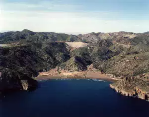
Originally, the Mar Menor was a bay open to the Mediterranean, but over time, volcanic ends formed a strip of dunes and vegetation that united both ends, creating extensive beaches that were later urbanized. However, the channels called “golas” maintain communication between the two seas, renewing the water.
Activities
La Manga offers a wide range of services and attractive leisure activities, with its sandy beaches and crystal-clear waters being the main draw.
Below are descriptions of some of the best beaches and coves in the region.
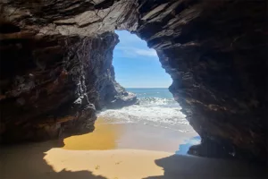
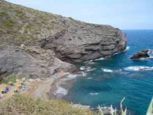
Calblanque beach
The Calblanque Regional Park is located at the eastern end of our coastline, between Cabo de Palos and Portmán. This enclave stands out for its great diversity of environments, including pine forests, scrublands, ravines, sandy areas, dunes, paleodunes, coves, and cliffs, as well as an endorheic basin that houses the Salinas del Rasall, a wetland included in the ZEPA Mar Menor.
During the summer, many people visit Calblanque to enjoy its beaches, so it is essential to regulate motor vehicle access to the park to preserve this unique environment. Information about the beach access management system “Calblanque 4:40” is available on the Murcia Natural website.
In La Cala, you will find a hostel and information center, Las Cobaticas:
Phone: +34 649 227 582
Email: infocalblanque@carm.es
Opening hours:
From September 16 to June 14:
Tuesday to Saturday: 9:00 a.m. to 2:00 p.m. and 3:00 p.m. to 5:30 p.m.
Sundays and holidays: 9:00 a.m. to 3:00 p.m.
From June 15 to September 15: (Schedule pending confirmation during the beach access management period)Tuesday to Thursday: 9:00 a.m. to 3:00 p.m.
Friday and Saturday: 9:00 a.m. to 3:00 p.m. and 4:00 p.m. to 7:30 p.m.
Sundays and holidays: 9:00 a.m. to 3:00 p.m.
Center closed:
Every Monday, except November 1 and December 6.
Holidays: January 1, 5, and 6; April 1; May 1; December 24, 25, and 31.
For staff training: February 24; May 26 and 27; December 15 and 16.
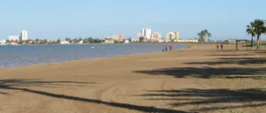
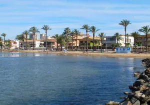
Playa Honda
ocated on the shore of the Mar Menor, a saltwater lagoon of the Mediterranean Sea in the Campo de Cartagena region, Playa Honda is to the west of the Caravaning Camping and to the east of Playa Paraíso and the Salinas de Marchamalo.
The climate of the Mar Menor is warm and dry Mediterranean, with mild winters and hot summers, reaching 38 °C in July and August, and rarely dropping below 5 °C in winter, with an annual average of 16-18 °C.
The beach, with fine golden sands, has been awarded the Blue Flag.
Services and activities:
The promenades of Playa Honda are wide and offer 360-degree views due to the flatness of the beach. Along the beach, there are beach bars with sun lounger and umbrella rentals, as well as portable toilets, selective waste containers, foot showers, trash cans, walkways, ramps, and a children’s play area.
Accessibility:
Playa Honda has four parking spaces for disabled people, two at the access point and two near the new toilets. There is a ramp with a 6% incline and 2-meter-long wooden walkways over the sand. There are also two toilets and an adapted changing room near the access point. The beach has adapted shaded areas and a beach chair and crutches provided by Civil Protection, recommended to be accompanied for swimming.
Cala Cortina
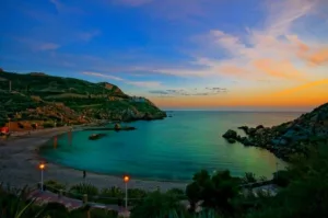
Cala Cortina, a picturesque cove in Cartagena, is reached by skirting the port of Cartagena through the Santa Lucía neighborhood.
Cala Cortina is a beach located in the municipality of Cartagena, near the port and the city, in the Santa Lucía neighborhood. It is 210 meters long and 28 meters wide. It is popular among Cartagena residents for its convenience and services, such as restaurants and picnic areas.
Location and services:
To access Cala Cortina from the city, you must skirt the port through the Santa Lucía neighborhood and pass through a tunnel. This route serves as a tourist walk, allowing you to see the natural port surrounded by cliffs and mountains. The viewpoint, which also serves as a parking lot, offers impressive views of the cove and the Mediterranean Sea. After the latest renovations, the beach has a children’s play area, a promenade, sun loungers, umbrellas, and a restaurant. In 2019, it was selected as the second-best beach in Spain by readers of Condé Nast Traveler magazine.
The beach is sandy, and a few meters from the shore, there is a natural islet. In the rocky areas and at the ends of the beach, fishing and diving are practiced.
La Cala Beach
Playa El Gorguel
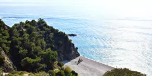
Between La Manga and Cartagena, El Gorguel Beach is a tranquil option with 50 meters in length and 110 meters in width.
It has excellent waves and darker sand, making it perfect for those seeking privacy.
It is advisable to bring a map or receive directions to find it. It is an isolated beach with little public influx. Its charm is somewhat diminished by the poor state of the surrounding natural environment.
This area is protected:
LIC (Sites of Community Importance)
The area has vegetation
Location:
Access: Easy by foot, car, boat
The accesses are signposted
The nearest road is La Unión to Portman
Islas Menores Beach
The urban beach of the Mar Menor, 900 meters long and 20 meters wide, offers a promenade and a yacht club. Its fine golden sands, calm waters, and existing lifeguards make it safe. It also has kiosks and toilets, making it very comfortable for visitors, and it has a high influx of public.
It is well equipped, with the Yacht Club located at one end. The beach has a gentle slope and warm waters, and in 2014, it was awarded the “Q” for Tourist Quality. The average annual temperature is 17ºC. The Gran Recorrido GR 92 trail passes through the beach, and there is vegetation along the promenade.
Location:
This is one of the beaches of Cartagena, located in the province of Murcia, in the Region of Murcia. Coast: Costa Cálida.
Length: 900 meters
Width: 20 meters
Environment: Urban
Composition: Sand
Bathing conditions: Calm waters
Nudist beach: No
Occupancy rate: High
Urbanization level: Urban
Promenade: Yes
Protected Natural Area
RAMSAR, LIC, ZEPA (Special Protection Areas for Birds)
ZEPIM (Specially Protected Areas of Mediterranean Importance)
APFS (Areas of Protection for Wildlife)
Vegetation: The area has vegetation
Access
Access: By foot (easy), car, boat
Signposted: Yes
Disabled access: Yes
Nearest road: Autovía de La Manga – MU-312, Exits 8 and 9
Parking: More than 100 spaces
Bus: Urban
Services
Toilets
Foot showers
Trash bins
Regular cleaning: The beach is cleaned regularly
Food and Drink
Umbrella and sun lounger rental
Nautical equipment rental
Yacht club
Sports area
Mooring area
Marina: Club Náutico Islas Menores
Safety
Lifeguard team: Available during the summer season
Danger signals: If there is danger, it is signposted
Cala del Pino
Cala del Pino is a beach located in La Manga del Mar Menor, in the municipality of Cartagena, Region of Murcia, and is washed by the waters of the Mar Menor.
It is an urban beach with services, stretching between Camino Noray and Camino Sextante. Since 2008, it has held the Q for Tourist Quality and Blue Flag certifications.
Information
Length: 150 meters
Width: 40 meters
Environment: Urban
Composition: Sand
Bathing conditions: Calm waters
Nudist beach: No
Occupancy rate: High
Urbanization level: Urban
Promenade: Yes
Characteristics
Protected Natural Area:
RAMSAR, LIC (Site of Community Importance), ZEPA (Special Protection Areas for Birds)
ZEPIM (Specially Protected Areas of Mediterranean Importance)
APFS (Areas of Protection for Wildlife)
Vegetation: The area has vegetation
Location
Access: By foot (easy), car, boat
Signposted: Yes
Disabled access: Yes
Nearest road: Autovía de La Manga – MU-312, Gran Vía, Exit 33
Parking: Less than 50 spaces
Bus: Urban

