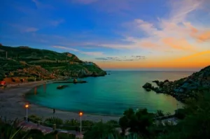
The paths of the Mar Menor and Calblanque Spaces are located within four Protected Natural Areas.
These are the Regional Park of Salinas de San Pedro, Regional Park of Calblanque, Protected Landscape of Cabezo Gordo, and Protected Landscape of Open Spaces and Islands of the Mar Menor.
Access to these natural spaces is possible from the Mediterranean Motorway AP-7 (Salinas de San Pedro and Carmolí), La Manga Fast Lane MU-312 (Calblanque), and C-3319 (Cabezo Gordo).
The Network of Natural Trails of the Region of Murcia traverses areas of great natural value, we must respect and preserve them for future generations.
EQUIPMENT: Hikers must have appropriate footwear and clothing according to the season of the year.
WEATHER: Make sure you check the State Meteorological Agency information (www.aemet.es), carry plenty of water, a hat, sunscreen, and sunglasses, specially during the summer as there is high insolation and temperatures in the Region of Murcia.
ORIENTATION: Trail information and signage do not guarantee the absence of orientation problems. Carrying a map of the area, a compass, and/or GPS is advisable. Maintaining signs and infrastructure is crucial for everyone’s safety and enjoyment. Report any deterioration or loss to the forest ranger, personnel of the Natural Spaces, or the Directorate General of the Natural Environment.
It is important to assess the route’s duration and difficulty according to our physical capacity and experience. The difficulty levels (M.I.D.E. System) are designed for optimal seasons and favorable weather conditions.
The risk on the trails is low, but it is not absent and its route’s duration is calculated as the effective walking time, excluding breaks and stops.
It is the hiker’s responsibility to keep the trails clean and dispose of any garbage in nearby containers.
Fires should only be lit in designated places and times.
Forest fires are a serious threat to natural spaces.
Plants should not be collected, nor should wildlife be disturbed.
Binoculars and a camera are useful for enjoying and documenting nature.
Staying on the proposed trail limits and respecting private property and local ways of life is essential.
If trails pass through roads suitable for motor vehicles, walk on the left side and, if in a group, in single file. In an emergency, call 112.
ENCAÑIZADAS TRAIL
 Information:
Type: Circular.
Distance: 11.9 km.
Estimated Time: Approximately 2 h. 40′ of effective walking time (excluding stops).
Start and End: Visitors Center “Las Salinas”.
Ascent: None. Descent: None.
IGN Cartography 1:25,000: 956-I San Javier and 935-III San Pedro del Pinatar.
Directions: This trail proposes to traverse entirely, through white and yellow markings of the PR, the boundaries of the Regional Park of Salinas de San Pedro, enjoying its multiple landscapes.
Next to the roundabout dedicated to the flamingo, an emblematic image of the Park, you will start towards the Pinar del Coterillo, surrounded by the captivating landscape of the salt pans.
Once at Curva de la Culebra, join the Senda de El Coterillo (local trail with white and green markings) to head south, parallel to the road, towards the Coterillo Information Point.
Before that, visit the bird observatory of the Charca del Coterillo, the only wetland not used for salt production. On the right, observe the Salinera Central, the nerve center of traditional salt resource use.
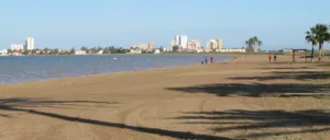
From the recreational area of El Coterillo and next to the Marine Resources Center, cross the road towards Llana Beach. Parallel to the San Pedro Port parking lot, arrive at the beach’s beginning next to the Red Cross lifeguard station.
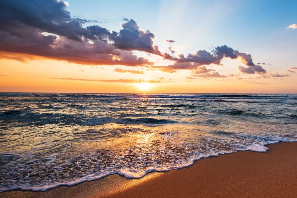
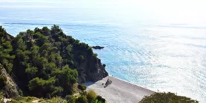
From here, a long and pleasant journey begins, taking us along Llana beaches to Punta de Algas. The name “algas” (algae) is due to the amount of oceanic seagrass sedimented on its shores.
Before Punta de Algas, cross the dunes to head west on firmer ground, again accompanied by the salt pans. On the left, distinguish the traditional fishing use of the Encañizadas. This capture art takes advantage of the natural corridor between the Mar Menor and the Mediterranean Sea to trap fish in their seasonal movements.
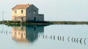
Our steps will turn north, between the waters of the Mar Menor and the salt pans, to reach one of the iconic elements of the Park, the Molino de la Calcetera. Together with the subsequent Molino de Quintín, it was used for emptying and filling the salt pans.
Shortly before finishing the long straight stretch, discover the popular Mud Baths, attributed therapeutic and healing properties. Close the complete return to our trail by walking along the urban promenade, which, along the Park boundary, leads us back to the roundabout where you started.
COTERILLO TRAIL
 Information:
Type: Circular.
Distance: 3,800 m.
Estimated Time: Approximately 1 h. of effective walking time (excluding stops)
Start and End: Coterillo Information Point.
Ascent: None.
Descent: None.
IGN Cartography 1:25,000: 956-I San Javier and 935-III San Pedro del Pinatar.
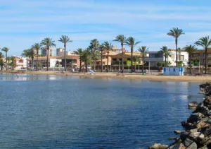
Directions: The wetland of the Regional Park of Salinas de San Pedro is an unparalleled ecological system on Spain’s southeastern coast. It extends throughout the territories of the Region of Murcia.
In this park, we find the four protection figures recognized in the Region of Murcia: Regional Park, SPA, Ramsar Site, and ZEPA. The Coterillo Information Point, next to the Charca del Coterillo, is the meeting point of this circular trail.
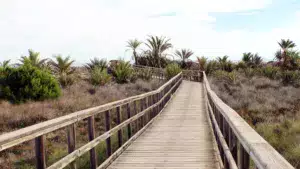
Starting from the same center, cross the road, surrounded by typical dry salt marsh vegetation. Along its winding path, discover the multiple uses and resources this natural space offers and the activity of the inhabitants.
Among the flora, sea lavender (Limonium spp.) and black poplar (Populus nigra) in the river area stand out. The landscape is populated by birds adapted to the saline environment, coexisting with humans. Seagulls, coots, terns, egrets, stilts, and flamingos abound.
The diversity of migratory, sedentary, and transit birds makes this area one of Spain’s main ecological reserves. Before returning to our starting point, cross the road again. Observe the remains of an ancient Roman road that linked Carthago Nova with southern Murcia.
SENDERO DEL CABEZO GORDO TRAIL
 Information:
Type: Linear (one way).
Distance: 500 m.
Estimated Time: Approximately 10 minutes of effective walking (excluding stops).
Start: Cabezo Gordo Parking.
Access to Sima de las Palomas.
End: Mirador de la Sima de las Palomas.
Ascent: 43 m.
Descent: 0 m.
IGN Cartography 1:25,000: 955-II Roldán.
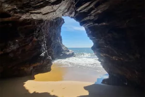
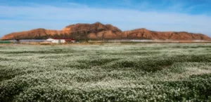
Directions: Cabezo Gordo has been declared a Protected Landscape due to its biological, landscape, paleoanthropological, and cultural value. This limestone hill, located in the municipality of Torre Pacheco, stands out as a distinctive feature in the sedimentary plain of the Mar Menor.
The numerous galleries inside are the result of ancient mining activities. These galleries host a remarkable fauna, including a population of bats.
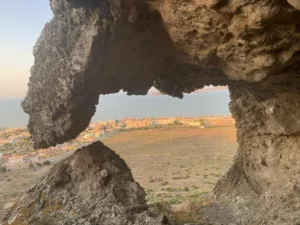
During this short walk, visitors can appreciate the most relevant plant communities on the slopes, such as Cornic and Lastonar, protected species adapted to dry environments. At the end of the route, on the sunny side, is the entrance to the Sima de las Palomas. This internationally renowned paleoanthropological site has provided fossil remains of hominids and animals that inhabited the region between 130,000 and 35,000 years ago.
Among the findings are jaws and skulls belonging to Neanderthal Man, who lived in this area about 50,000 years ago. With more than one hundred fifty identified fossil remains, this site is considered the most important of its kind in the Spanish Mediterranean arc.
The presence of Mousterian tools from the Paleolithic, as well as remains of animals and plants, further increases the site’s importance. From the trail’s end, enjoy an interesting view of the Mar Menor and the fertile surrounding plain, with its characteristic hills, islands, islets, and La Manga.
CARMOLÍ ROUTE
 Information:
Type: Circular.
Distance: 2,000 m.
Estimated Time: Approximately 50 minutes of effective walking (excluding stops).
Start and End: Calle Lago Superior, Punta Brava (Cartagena).
Ascent: 57 m.
Descent: 57 m.
IGN Cartography 1:25,000: 956-I Los Alcázares.
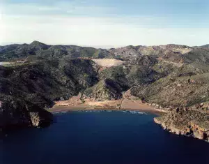
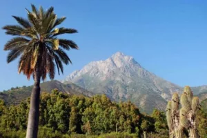
Directions: Cabezo de El Carmolí, like the volcanic islands of the Mar Menor and Isla Grosa, emerged 10 million years ago in the Mediterranean.
With a height of 112 meters, this volcanic formation offers a spectacular view of one of Europe’s unique geographical features: the Mar Menor and La Manga.
From its slopes, rising above the calm waters, you can see Isla de la Perdiguera in the foreground and Isla Mayor or del Barón beyond.
Other protected natural areas, such as Marina del Carmolí, Saladar de Lo Poyo, Cabezo de San Ginés, and Isla Grosa, can also be spotted. During the hike through this protected natural space, visitors can enjoy curious geological formations, such as columnar jointing, designated as a Geological Point of Interest due to their volcanic origin and the diversity of materials they contain.
Despite being affected by intensive grazing and aromatic plant harvesting in the past, botanical species such as palm trees, wild olive trees, hawthorns, and others typical of warm and dry climates can still be found. Along this circular route, there are military remains
ROUTE AROUND CABEZO DE LA FUENTE
Information:
Type: Circular.
Distance: 7,800 m.
Estimated Time: Approximately 2 hours and 30 minutes of effective walking (excluding stops).
Start and End: Information and Management Point “Las Cobaticas”.
Ascent: 175 m.
Descent: 175 m.
IGN Cartography 1:25,000: 978-I Llano del Beal.
Directions: The route starts at the Cobaticas Visitor Center, a reconstructed and adapted building resembling traditional cubic houses. Following the white and yellow marks of the short-distance trail (PR), we proceed circularly, experiencing the landscapes and historical elements around Cabezo de la Fuente. Initially, we move north towards La Jordana houses, then join the livestock route of Colada de la Fuente Jordana, passing Las Barracas and Fuente Grande among cultivated areas and palm tree slopes.
Next, we pass the House of Los Mateos and the Houses of La Pedriza, reaching Fuente Grande, a pilgrimage site in May. After a rest, continue south through Huncos hamlets, ascend a trail to a small hill, and join the GR-92 trail (white and red marks). Enjoy an excellent viewpoint with panoramic views of Cabezo de la Fuente and the sea. Descend parallel to the coast, passing the Negrete Beach parking lot, walking alongside Moro juniper or Cartagena cypress specimens.
Pass the viewpoint of Playa Larga, continue to the covered parking lot of Playa de las Cañas. Ascend towards Cobaticas and the Information Point, bidding farewell to the route with a typical coastal landscape.
MONTE DE LAS CENIZAS TRAIL
 Information:
Type: Linear (one-way).
Distance: 3 km.
Estimated Time: 50 minutes of effective walking (excluding stops).
Start: Intersection between the Portmán – Los Belones road and the Llano del Beal road, Km 11.2.
End: Monte de las Cenizas Viewpoint.
Ascent: 166 m.
Descent: 0 m.
IGN Cartography 1:25,000: 978-I Llano del Beal.
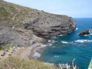
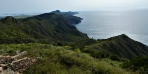
Directions: This trail traverses a dense pine forest on the shady slope of Monte de las Cenizas, an ecologically significant reserve area. The easy ascent allows for a comfortable family stroll, rewarding with a spectacular coastal landscape at the journey’s end. Access from the La Manga expressway, taking the exit towards Atamaría and Portmán in Los Belones. After approximately 5 km, reach the intersection with the Llano del Beal road. Follow the bike lane until reaching the barrier marking the entrance to Monte de las Cenizas, about 200 meters further up and to the left.
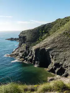
The trail starts here, dividing the sunny slope of Peña del Águila and the shady slope of Monte de las Cenizas. It winds through a dense forest of Aleppo pines, holm oaks, Cartagena cypresses, mastic trees, blackthorns, rosemary, palm trees, and other species. Initially, the journey (marked with white and yellow signs) offers magnificent views to the east of the Mar Menor and La Manga. After a pass, the path descends towards the western slope, offering impressive views of the Bay of Portmán, an important Roman strategic enclave known as Portus Magnum.
Mining exploitation left the bay with ochre and gray landscapes, but an environmental regeneration plan offers hope. The trail ends at the Monte de las Cenizas military battery, passing an imposing concrete entrance inspired by the Temple of the White Warriors of Chichen-Itzá, built in 1931 on earlier structures, defending the coast near Cartagena. Following the path to the left, arrive at a circular viewpoint with a “Vickers” cannon, enjoying magnificent panoramic views of the Mar Menor to the east and the cliffs of the Sierra de la Fausilla and Cape Tiñoso to the west.
PUNTA NEGRA VIEWPOINT TRAIL
 Information:
Type: Linear (one-way).
Distance: 3,850 m.
Estimated Time: 50 minutes of effective walking (excluding stops).
Start: Covered parking at Playa de las Cañas.
End: Punta Negra Viewpoint.
Ascent: 35 m.
Descent: 15 m.
IGN Cartography 1:25,000: 978-I Llano del Beal.
Directions: The Regional Park of Calblanque, Monte de las Cenizas, and Peña del Águila is a well-preserved natural treasure in the western Mediterranean. Its rugged landscape stretches from the east to Andalusian lands, encompassing the entire Murcian coast. This pleasant route is part of the long-distance trail GR-92, offering views of salt flats, dune systems, crops, and extensive scrubland.
Start at the parking lot of Playa de Las Cañas, following the white and red marks of the GR heading east. Cross the arboretum near the parking lot, descend along the Rambla de Las Cobaticas or Las Cañas, and turn left towards the salt pans. The Cerro del Atalayón stands out to the east, while Cabezo de la Fuente rises behind us. Before reaching the Rasall Salt Pans, detour towards La Timba, where the old water supply for the salt pans is located.
Continue towards the Rasall Salt Pans, circling around the north side. The dense vegetation leads to Bird Observation Posts, where various species can be spotted. Follow the track between palm trees and old country houses, reaching the Punta Negra viewpoint. Here, admire the panoramic view of the plain traveled, a harmonious combination of sea and mountains, with Cabezo de la Fuente as the backdrop.
CERRO DE LA CAMPANA TRAIL
 Information:
Type: Circular.
Distance: 2,800 m.
Estimated Time: Approximately 1 h. of effective walking time (excluding stops).
Start and End: Visitor Information Center “Cabezo de la Fuente” (Calblanque).
Ascent: 80 m.
Descent: 80 m.
IGN Cartography 1:25,000: 936-IV Cartagena and 956-II Los Alcázares.
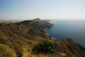
Directions: In the Calblanque Regional Park, this short but scenic hiking trail runs along the Cerro de la Campana. Firstly, from the Cabezo de la Fuente Information Point, the ascent to the top of the hill begins. Moreover, this path leads through a geomorphological landscape dominated by gullies. Specifically, these gullies are formed by water runoff.
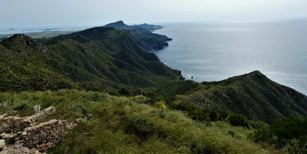
The hill is covered with a holm oak forest, while the northern slope is dominated by Mediterranean scrub with abundant junipers and rosemary. Halfway through the climb, observe a large limestone block appreciated by climbers. At the highest point, at 259 meters above sea level, enjoy a panoramic view of the coast and the marine reserve of Cabo de Palos-Islas Hormigas.
From this vantage point, distinguish the Atamaria massif to the northwest, the La Muela massif to the north, and Monte de las Cenizas to the northeast. To the southeast, observe coves and beaches of Cartagena, including Calblanque beach. On clear days, see the La Manga strip, the La Manga lighthouse, and even the Mar Menor.
CALBLANQUE COASTAL TRAIL
 Information:
Type: Circular.
Distance: 8,000 m.
Estimated Time: Approximately 2 h. of effective walking time (excluding stops).
Start and End: Visitor Information Center “Cabezo de la Fuente” (Calblanque).
Ascent: 70 m.
Descent: 70 m. IGN Cartography 1:25,000: 936-IV Cartagena and 956-II Los Alcázares.
Directions: This route combines two trails in the Regional Park: the Sierra de la Fausilla and the Llana, providing a complete tour of the northern slope of the Calblanque mountain range. From the Cabezo de la Fuente Information Point, head south towards Plan del Rubio. At the fork, take the left path, leaving the direct ascent to Sierra de la Fausilla.
Cross a wide esplanade with remains of an ancient lime kiln, continue through a holm oak forest to Molino del Agua. Here, take a small detour to find the old well and lime kiln. Continue ascending to the old livestock path linking Calblanque beaches with Los Belones. Gain height quickly, enjoying spectacular views of the Mediterranean Sea and the coastline.
On the mountain crest, the path changes direction west and descends towards the Llana, an area of great environmental value. Observe a wide variety of birds adapted to saline environments, like the white-headed duck, black-winged stilt, and pochard. Throughout the route, distinguish Monte de las Cenizas to the northwest and Monte Atalaya to the northeast. Along the well-conditioned path crossing a pine forest and scrubland, return to the starting point.